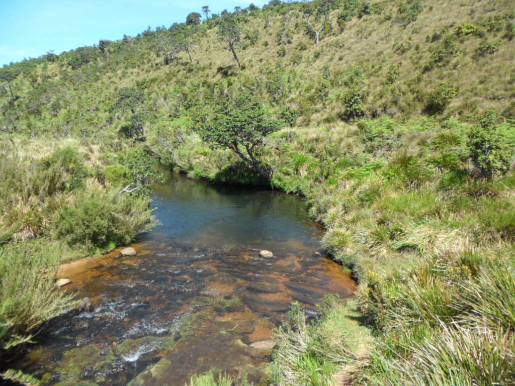
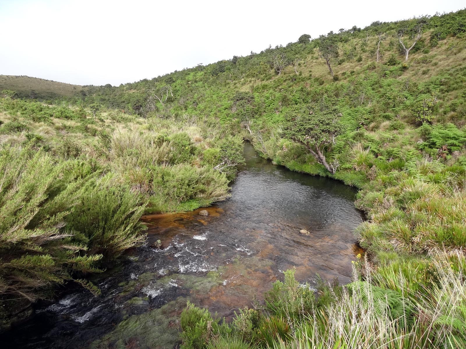
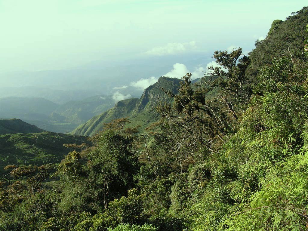
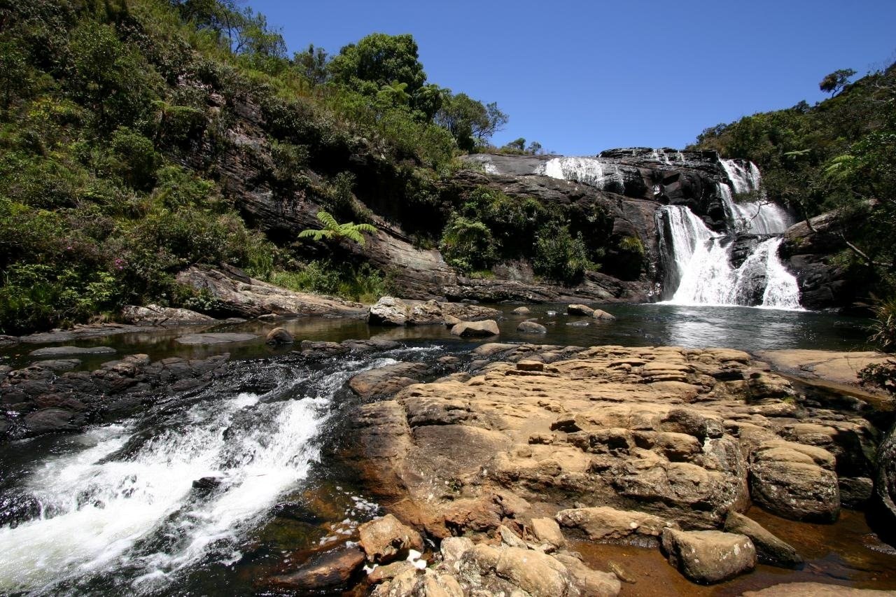
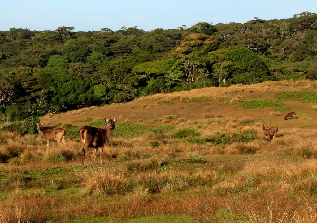
Horton Plains National Park, 32 kilometers from Nuwara Eliya, is in stark contrast to Sri Lanka’s other parks because it is situated at an altitude of 2,100 meters, the island’s highest tableland. The plains, which have been compared to the Scottish moors, have a strange atmosphere and scenic beauty that cannot be found elsewhere in Sri Lanka. Horton Plains National Park is of considerable conservation importance as it contains most of the habitats of endemic plants and animals representative of the country’s wet and montane zones. Indeed, the western slopes of the plateau on which the Horton Plains are situated support the most extensive area of montane cloud forest in Sri Lanka. From this plateau rise the island’s second and third highest peaks, Kirigalpotta (2,387 m) and Thotupolakanda (2,357m). These peaks are of course only several hundred meters higher than the plateau and the latter in particular can be climbed with ease through stunted vegetation.The tributaries of three rivers originate on the Horton Plains - the Mahaweli Ganga flowing to the north, the Kelani Ganga to the west and the Walawe to the south. The park also contains Baker’s Falls, a 20 meter high waterfall on the BelihulOya (a stream that also rises on the Plains), which plunges over a wide black rock down into a gorge.
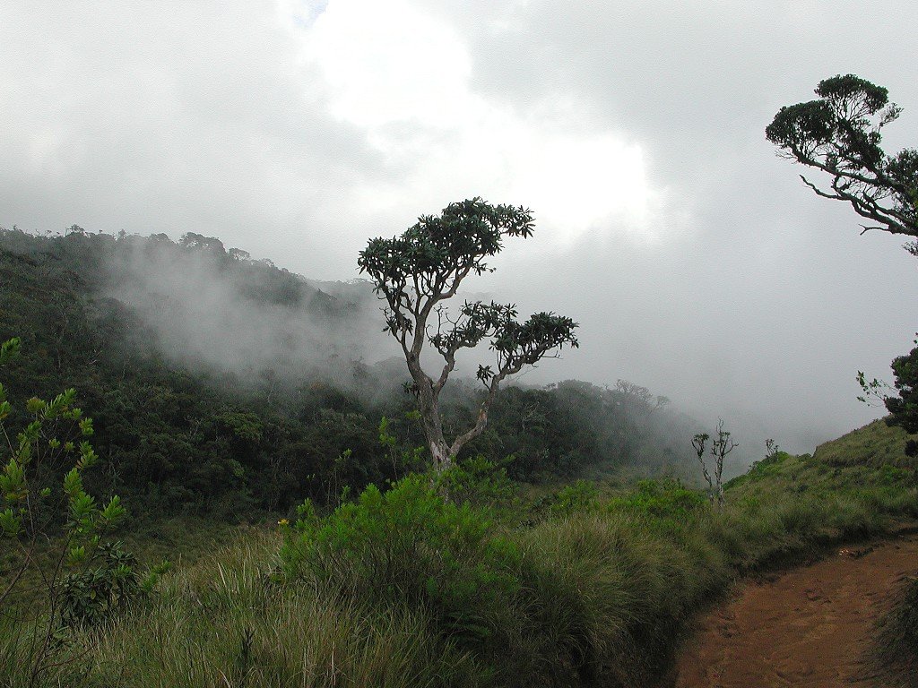
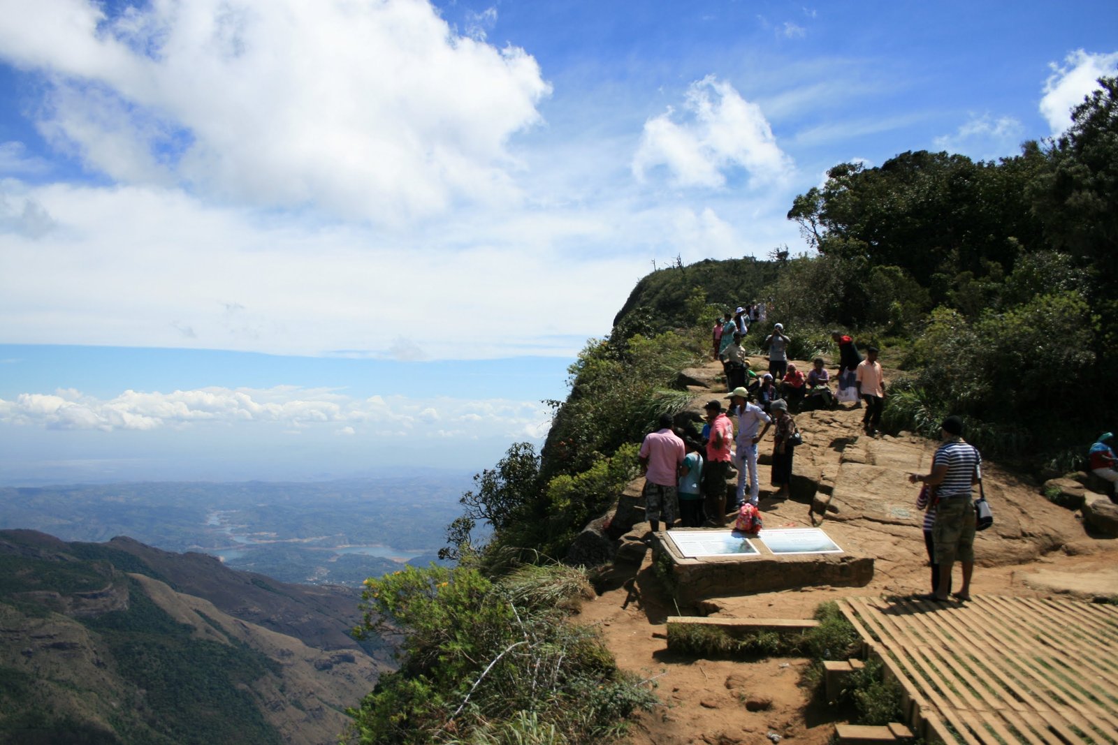
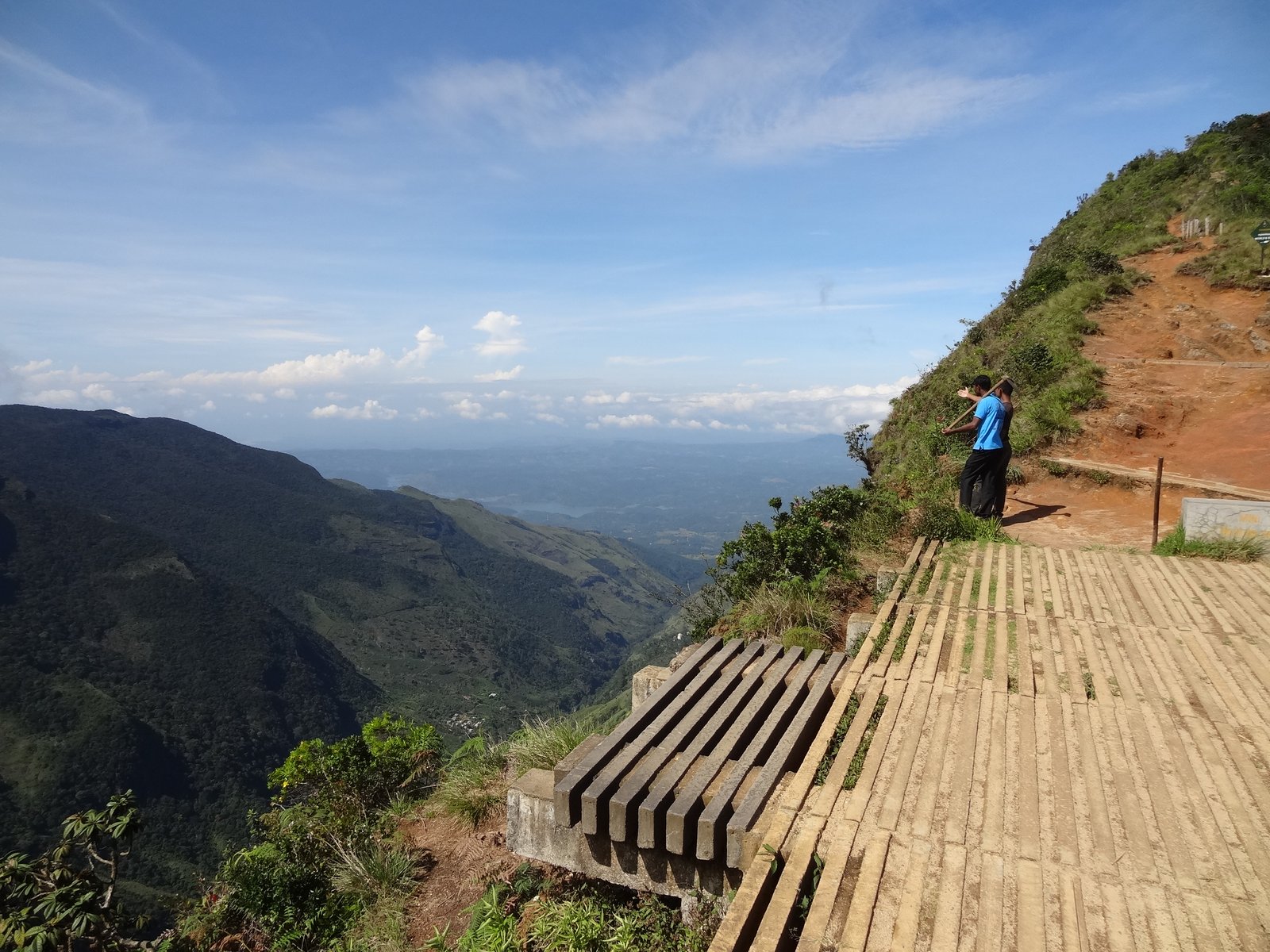
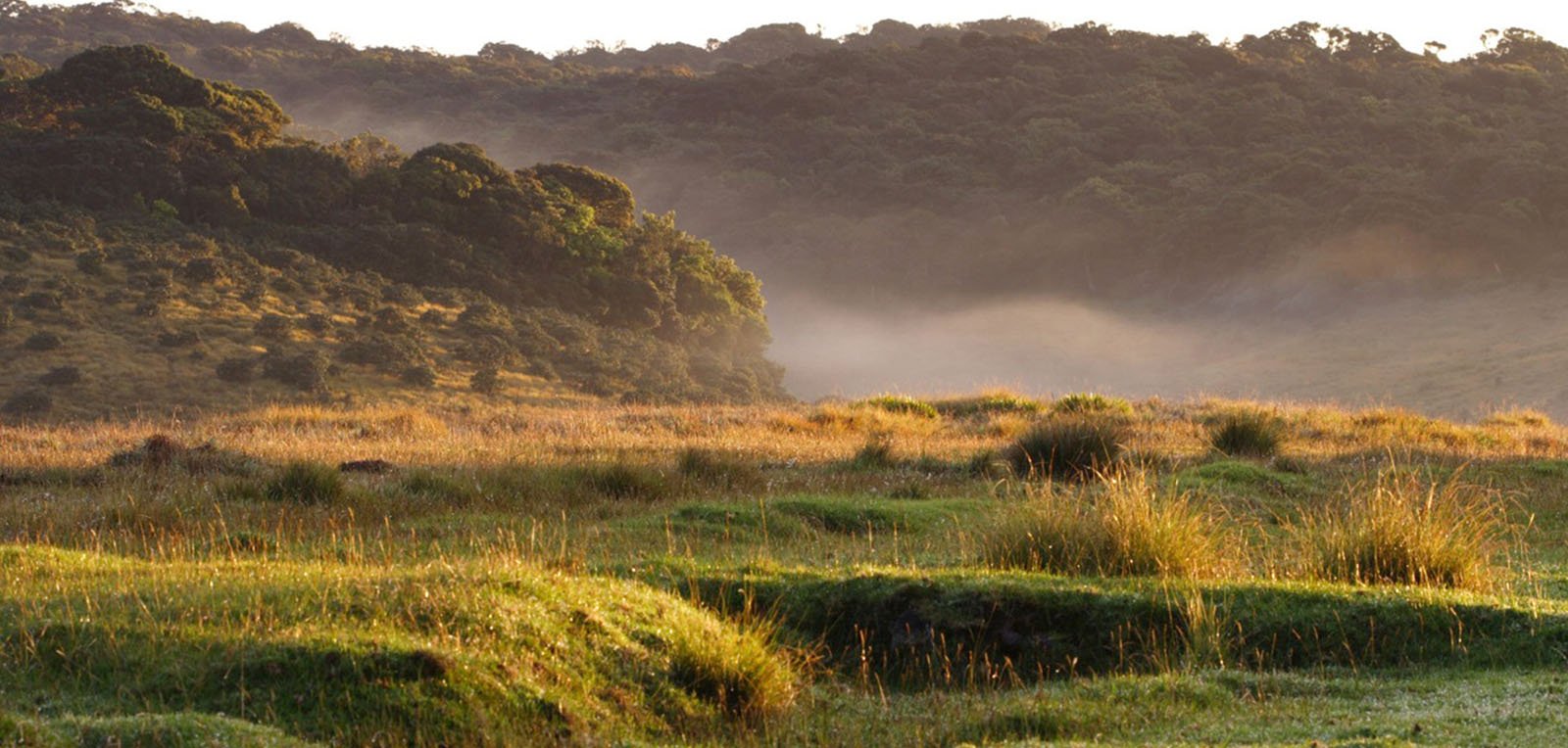
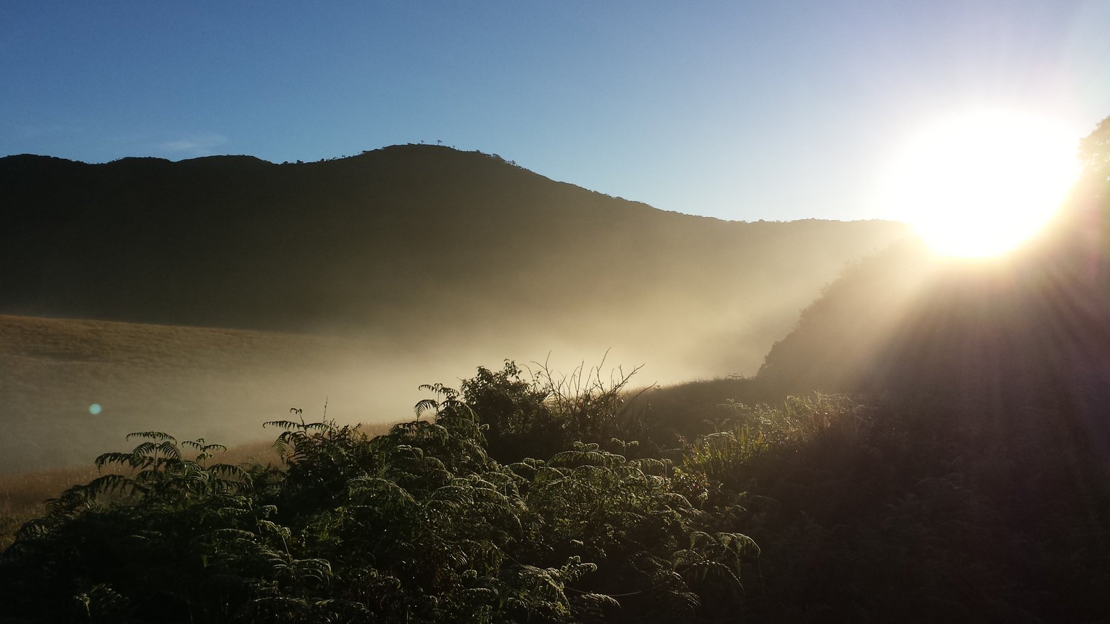
However, the most awesome physical feature of the Horton Plains - and perhaps the whole of Sri Lanka - is the escarpment at the edge of the plateau that falls 880 metres to the lowlands of the southern region of the island. Aptly known as World’s End, the view from the precipice of the countryside below towards the south coast is spectacular. Unfortunately, however, this view is often obscured by mist, especially during the rainy season from April to September. Dawn or early morning is undoubtedly the best time for observing it. The German zoologist Ernst Haeckel wandered alone through the Horton Plains in 1882.“I shall never forget,” he writes, “the delicious stillness of the days I spent in the sombre woods and sunny savannahs at the World’s End.” He was struck by “the fantastical forms of the trees of the primaeval forest, the gnarled and tangled growth of their trunks and the forked boughs, bearded with yard long growths of orange mosses and lichens, and robed with rich green mantles of creepers.”
A particular physical feature of the Horton Plains (and indeed the whole central massif of the island) is the patana. This is defined in the Oxford English Dictionary as “a glade in the jungle-covered mountainous districts of Sri Lanka, usually with sloping sides.” Some believe the patanas were created artificially by deliberate forest clearance many centuries ago, while others believe they are an entirely natural product of its particular climatic conditions.
The Horton Plains area was known as Mahaelilya until a British planter called Thomas Farr explored it and named it after Sir Robert Horton, a former governor who briefly travelled there in 1836. In 1873 the area first received protection under an order prohibiting the felling of forest at an altitude of more than 5,000 feet. Horton Plains was designated a nature reserve in 1969 and upgraded to a national park in 1988. It is 3,160 hectares in extent. This is the only national park in Sri Lanka where visitors are allowed to walk on their own on designated tracks. Accommodation, consisting of several bungalows and dormitories, is available within the park.


Location MAP
Nearby Hotels
